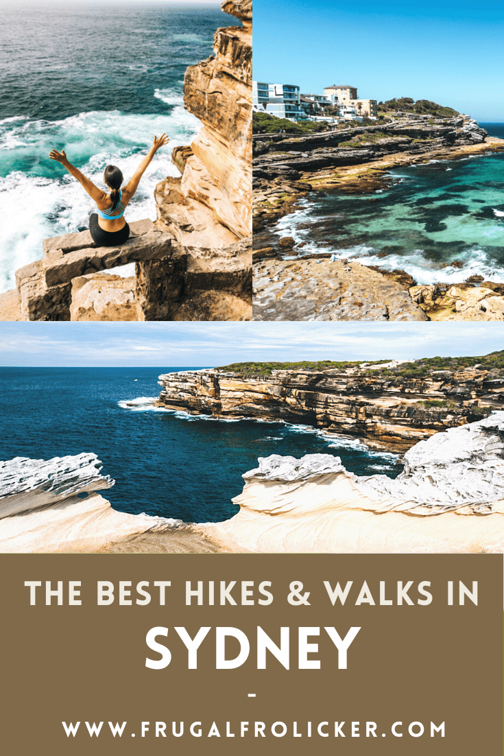
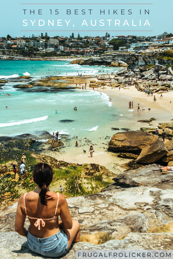
This post was last updated on 2024 April 11
This isn’t news to Sydneysiders, but did y’all know how good the hikes in Sydney are?
It’s true. There are dozens of walking and hiking trails in Sydney and surrounds. And they’re so damn accessible that hiking Sydney just becomes a part of your routine, whether it’s an after-work walk along the harbour or beach, or a Saturday spent completing a longer Sydney hike.
After 6+ cumulative years checking all of the Sydney Harbour walks and Sydney coastal walks off my to-do list (some several times over), I’m finally ready to bring you a definitive list of THE BEST hikes in Sydney.
Best of all, every single one of them allows for stops at the beach, whether at the beginning or end, or along the way :)
Enjoy!
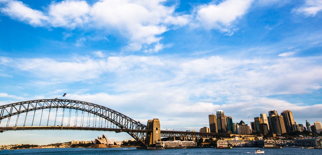
The Best Sydney Harbour Walks
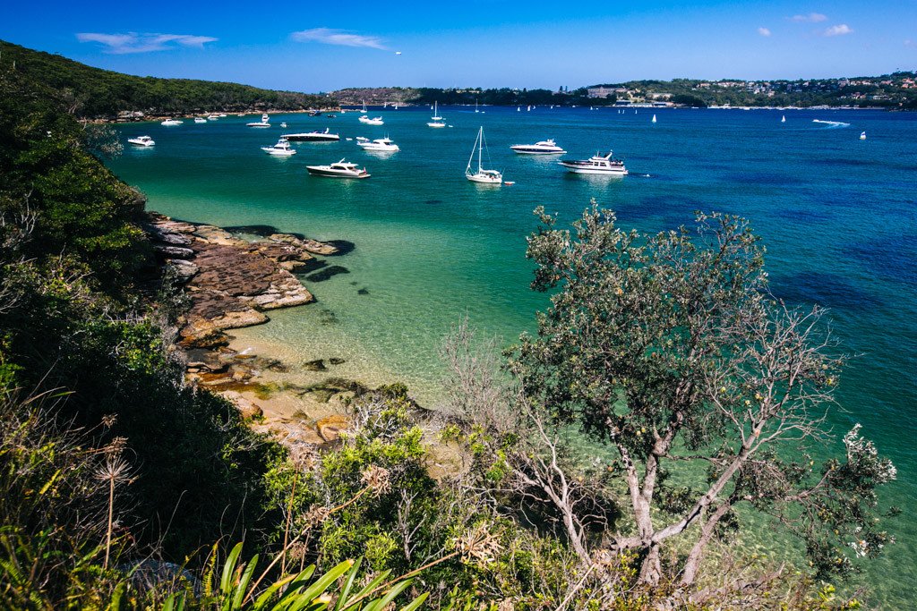
Manly to Spit
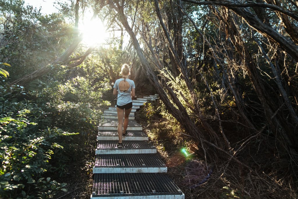
The Spit to Manly walk (aka the Manly to Spit walk) is one of the best bush walks in Sydney that you can do. It’s got a little bit of everything, including dramatic cliffs, sweeping Sydney Harbour views, aboriginal rock art, secluded beaches, and bushland.
There are a few side tracks you can take along the way to extend your hike, but there’s a good chance you’ll be easily able to fill your day with plentiful stops at some of the pretty beaches and viewpoints along the way.
You can complete this Sydney hike in either direction, but I always recommend ending in Manly so that you can relax afterwards at the beach or reward yourself with some food and drinks in Manly.
How to get there: Take a bus from Sydney CBD to Spit Junction to reach the start of the walk, then take the ferry from Manly to Circular Quay to get back to Sydney.
Length & Difficulty: 10km / moderate
How much time to allow: 4-5 hours if you take your time and stop off at any beaches or do the side treks; 3 hours if you only make quick stops along the way
You’ll love this Sydney hike if you enjoy: Secluded gold sand beaches, great harbour views, paths through the bush
READ MORE IN THIS POST: Spit to Manly Walk | Sydney Harbour Walk
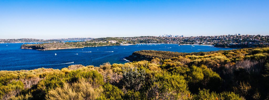
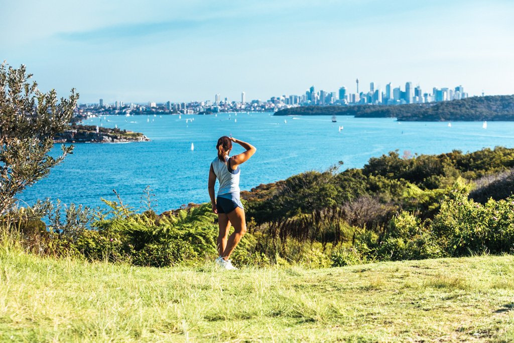
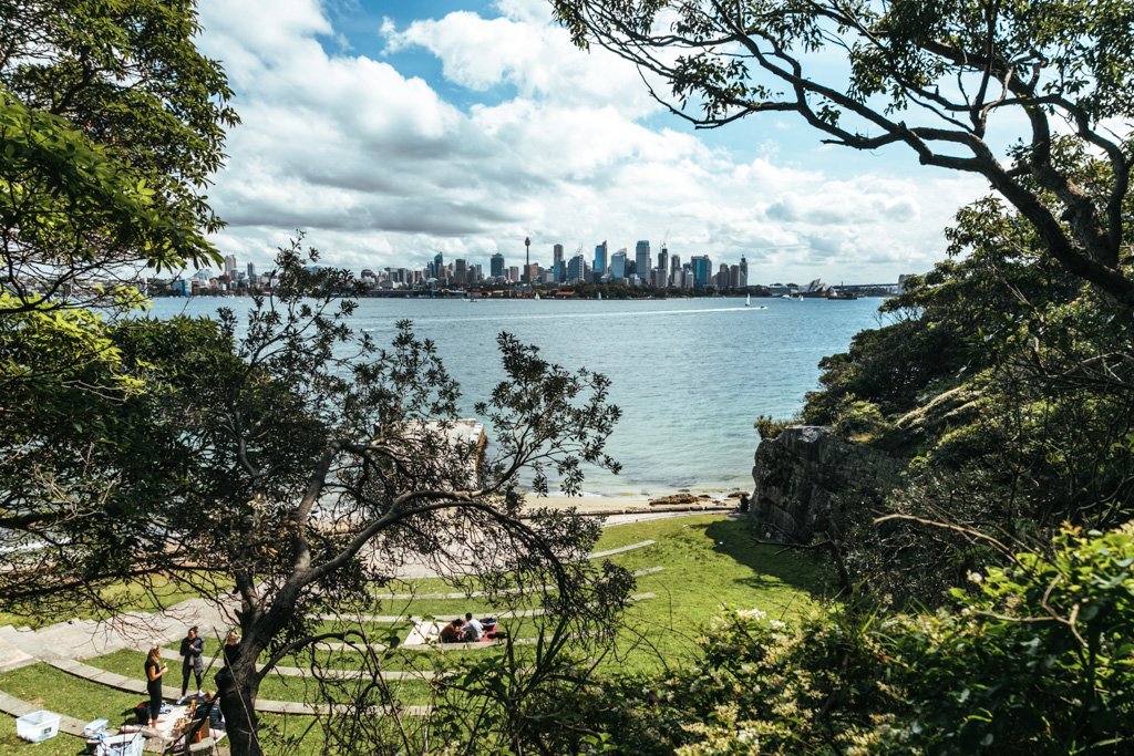
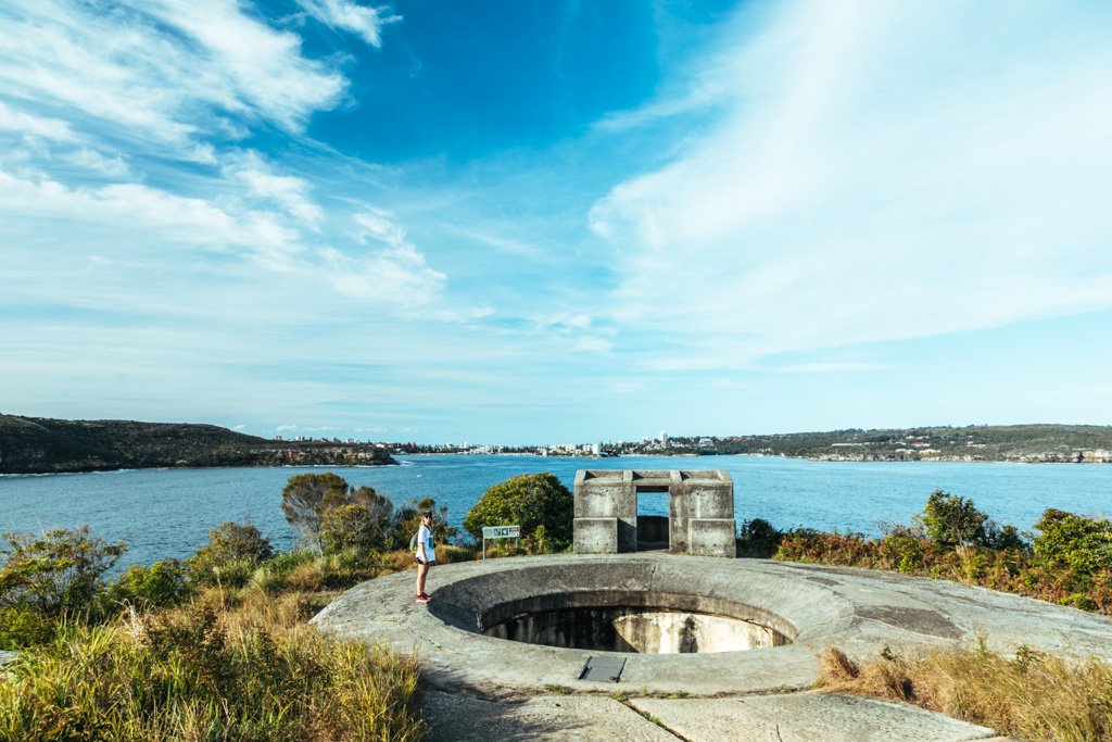
North Head Sanctuary Loop
The Manly to North Head walk (also known as the North Head Sanctuary Loop) is an 8km Sydney hike that starts from above Shelly Beach in Manly and loops up and around to the end of North Head, which is the outermost point of Sydney Harbour. It offers dramatic cliffs with sea views, interesting bushland, killer harbour views, and old military remnants.
I love this Sydney hike because it’s a bit off the beaten path and has one of the best views in Sydney at the very end (it’s a great spot for a picnic!).
How to get there: Take the ferry to Manly wharf and start walking!
Length & Difficulty: ~8km / easy
How much time to allow: ~ 3 hours return. Add more time if you’re visiting Q Station or taking a tunnel tour.
You’ll love this Sydney hike if you enjoy: Panoramic Sydney harbour views, history, bush walks in Sydney with few other people around
READ MORE IN THIS POST: Manly to North Head Walk: The North Head Sanctuary Loop
Bradleys Head Amphitheatre.
Taronga to Balmoral (Middle Head)
The full version of this Sydney hike spans from Taronga Zoo to Balmoral Beach, but the most popular segment of the walk is from Bradleys Head to Chowder Bay. I recommend you complete the entire bush walk if you have the time, which will take you around Georges Head and Middle Head, which offer some of the best views of the whole walk.
This is one of the best hikes in Sydney because it offers up views of both the inner and outer harbour, from the Sydney Harbour Bridge all the way around to Manly. It’s also a good one to do with kids, as it passes by some of Sydney’s most family-friendly beaches and has the Taronga Zoo at one end.
Middle Head.
How to get there: Take the ferry from Circular Quay to Taronga Zoo to start the hike.
If ending the hike at Georges Head, take the 244 to the city, or the 247 or M30 from Mosman to the city.
If ending at Balmoral Beach, take the 245 bus from the beach to the city, or the 178 or 230 from Mosman to the city.
Length & Difficulty: 4-9km / moderate
How much time to allow: Bradleys Head to Chowder Bay walk is 4km and should take you 1.5-2 hours depending on how often you stop. Chowder Bay to Georges Head, Middle Head, and Balmoral adds on an additional 5km and 2 hours of walking.
You’ll love this Sydney hike if you enjoy: Family-friendly beaches, nude beaches, harbour views, historic sites.
READ MORE IN THIS POST: Bradleys Head to Chowder Bay Walk + Balmoral | Sydney Harbour Walk
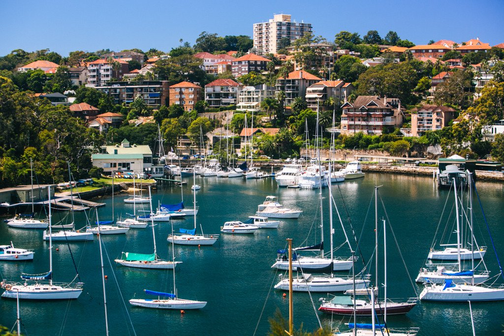
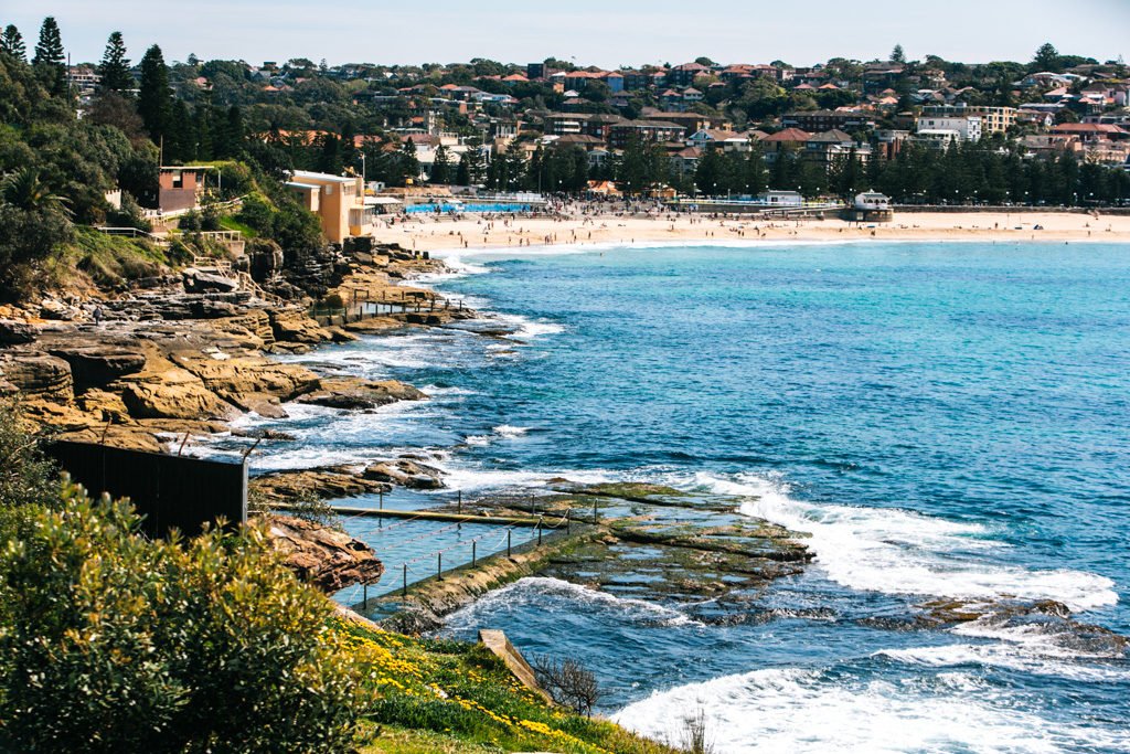
Mosman to Cremorne
Mosman to Cremorne is one of the best Sydney Harbour walks because it’s easy and offers up some sensational views of both the Sydney Opera House and Sydney Harbour Bridge (aka excellent bang for your buck).
The quickie version of this Sydney hike starts at South Mosman Wharf, but you might as well start at Taronga Zoo wharf for maximum enjoyment. It passes by several little quiet coves and exceedingly beautiful waterfront homes.
The BEST part of this Sydney walk comes at the end when you reach MacCallum Pool. This little pool is literally RIGHT on the harbourfront and boasts a backdrop with both the harbour bridge and opera house. Definitely come here before this spot becomes insta-famous (yes it’s that epic)!
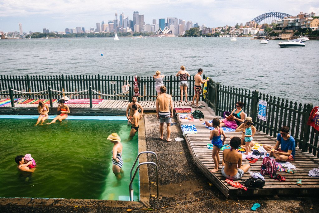
MacCallum Pool.
How to get there: From Circular Quay, catch either the F6 ferry to South Mosman or Mosman Bay, or the F2 ferry to Taronga Zoo and walk westward along the waterfront to Cremorne Point.
Length & Difficulty: 3km if starting from South Mosman wharf; 4km if starting from Taronga Zoo wharf / easy
How much time to allow: If walking nonstop, South Mosman – Cremorne Point takes about 1 hour and Taronga – Cremorne Point takes about 1.5 hours. Allow around 4 hours to fully enjoy the walk and its many viewpoints and swimming spots.
You’ll love this Sydney hike if you enjoy: Swimming with an epic harbour view, million-dollar houses with gorgeous gardens, quiet coves, fancy boats
READ MORE IN THIS POST: Mosman to Cremorne Point Walk | Sydney Harbour Walk

Hermitage Foreshore Track
The Hermitage Foreshore Track runs along the waterfront on the harbour side of Vaucluse, one of the more ritzy eastern suburbs. It starts along the east side of Rose Bay and wraps around Steele Point to Nielsen Park, ending at Shark Bay. From here, you can walk a bit further to Parsley Bay, a really unique Sydney beach because of the bridge that runs across it – just note that you’ll be walking on roads to get there, as there’s no coastal path beyond Shark Bay.
This is the shortest and easiest of the Sydney Harbour walks. I love it for its host of tiny beaches along Rose Bay which face the Sydney skyline. Because they’re west-facing, these beaches are ideal for late day sunbathing and also make for a great spot from which to have a picnic or watch the sunset.

Shark Beach.
How to get there: Take the 324/386 bus to Rose Bay; alternatively, you could start at the other end by taking the 325 bus to Nielsen Park (Vaucluse Rd near Greycliffe Av).
Length & Difficulty: 1.8km / easy
How much time to allow: The walk can be completed in 30 minutes – 1 hour without stopping for long. Allow more time if you want to swim or sunbathe at one of the beaches along the way.
You’ll love this Sydney hike if you enjoy: Secluded beaches, harbour views, a quick and easy stroll.
READ MORE IN THIS POST: Hermitage Foreshore Track | Sydney Harbour Walk
Camp Cove.
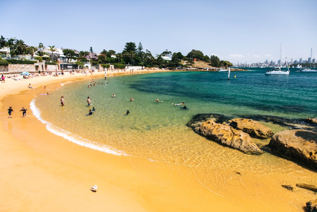
South Head & Watsons Bay
Directly across Sydney Harbour from North Head is… you guessed it, South Head: the other outermost point of the harbour, complete with dramatic cliffs, panoramic views featuring the distant Sydney skyline, a picturesque lighthouse, and Sydney’s most popular nude beach (Lady Bay).
This Sydney hike is in Watsons Bay and runs along some ocean cliffs before veering inland and around South Head to the harbour side of the peninsula. It’s one of my favorite hiking trails in Sydney because I adore the tree-framed views of Sydney Harbour along it. Plus, it goes through Camp Cove, which is one of the best beaches in Sydney (that orange sand!).
View from near The Gap.
How to get there: Take the 324 or 380 bus to Old South Head Road near Gap Park. There should be a sign at the park entrance, which is just before a very steep hill downwards.
Length & Difficulty: ~5km / easy
How much time to allow: The walk can be done in 2-2.5 hours, but you’ll want more time if you plan to stop off at any of the beaches or the historic sites.
You’ll love this Sydney hike if you enjoy: Rugged coastline, cliffs, secluded beaches, harbour views
READ MORE IN THIS POST: Watsons Bay & South Head | Sydney Harbour Walk
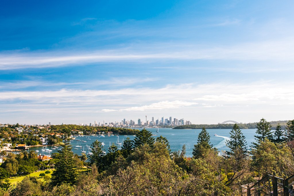
Milsons Point to Blues Point & Balls Head Reserve
This walk from Milsons Point is great for those with limited time in Sydney who want to soak up the best views of the city’s major landmarks as well as the harbor atmosphere.
From Milsons Point, you’ll head around picturesque Lavender Bay and out to Blues Point Reserve, which has a direct view of Sydney Harbour Bridge (I actually watched the NYE fireworks from Blues Point Tower in 2018, it was epic!).
Feel free to end your Sydney Harbour walk at Blues Point, or venture onward to Balls Head Reserve. This segment of the walk is slightly inland until you reach Waverton Park, and then it takes you to Berry’s Bay Lookout before you head out to Balls Head. This reserve is a top spot for a scenic picnic.
Lavender Bay.
How to get there: Take the train to Milsons Point station, or the ferry to Milsons Point wharf or Jeffrey Street wharf. From Balls Head Reserve, you can take the train back from Waverton station.
Length & Difficulty: 5km / easy
How much time to allow: The walk takes about one hour without stopping. Allow 2-3 hours for plenty of time to stop and enjoy all of the views.
You’ll love this Sydney hike if you enjoy: Close-up views of the Sydney Harbour Bridge and Opera House, flowers and foliage
Bronte Beach.
The Best Sydney Coastal Walks
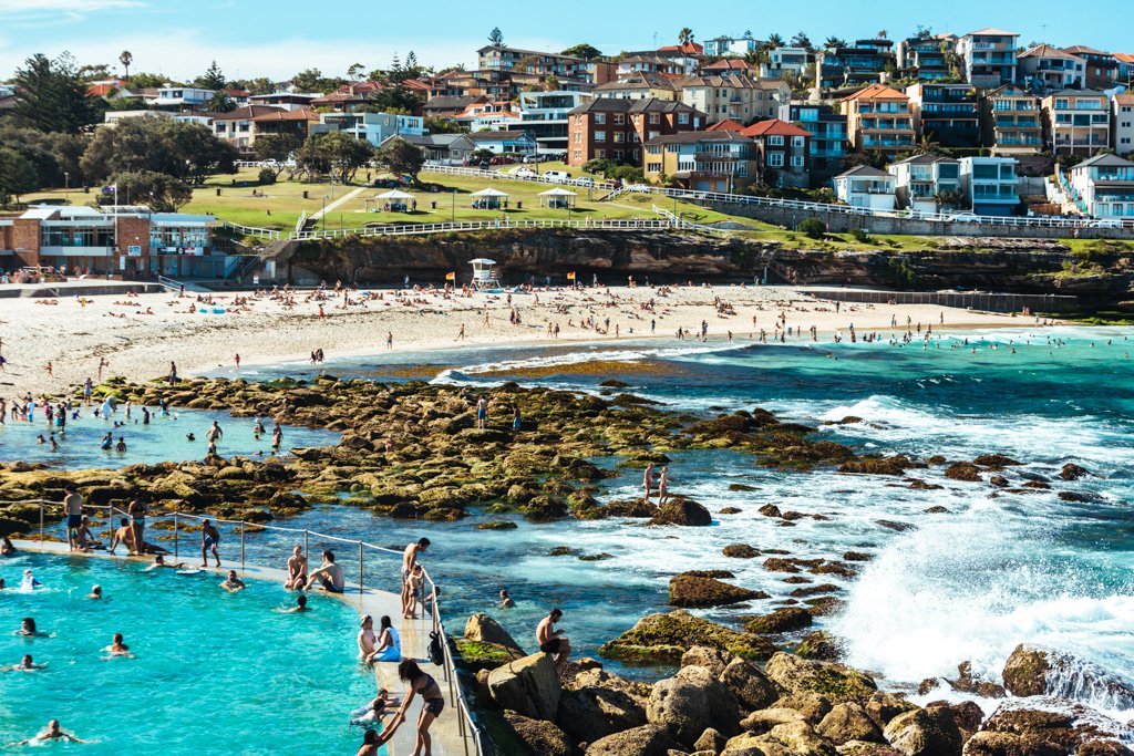
Bondi to Coogee
Behold, the most popular of the best walks in Sydney: the Bondi to Coogee walk.
Yes, it’s perpetually swarming with locals and tourists alike, but once you see it for yourself you’ll understand why. This is one of the most gorgeous and accessible slices of coastline around Sydney, with clifftop views and beautiful beaches galore. This Sydney hike is an absolute must-do if you visit.
Do yourself a favor and block off a whole day to devote to the Bondi to Coogee walk. This will give you plenty of time to stop off at viewpoints and swim at some of the beaches along the way, and/or spend some time in Bondi or Coogee on either end of the walk.
My favorite spot along the walk is Mackenzies Bay, which is just tucked around the corner from Tamarama Beach; at the moment (January 2020) Mackenzies is a proper beach, but ordinarily there’s no sand visible at this bay.
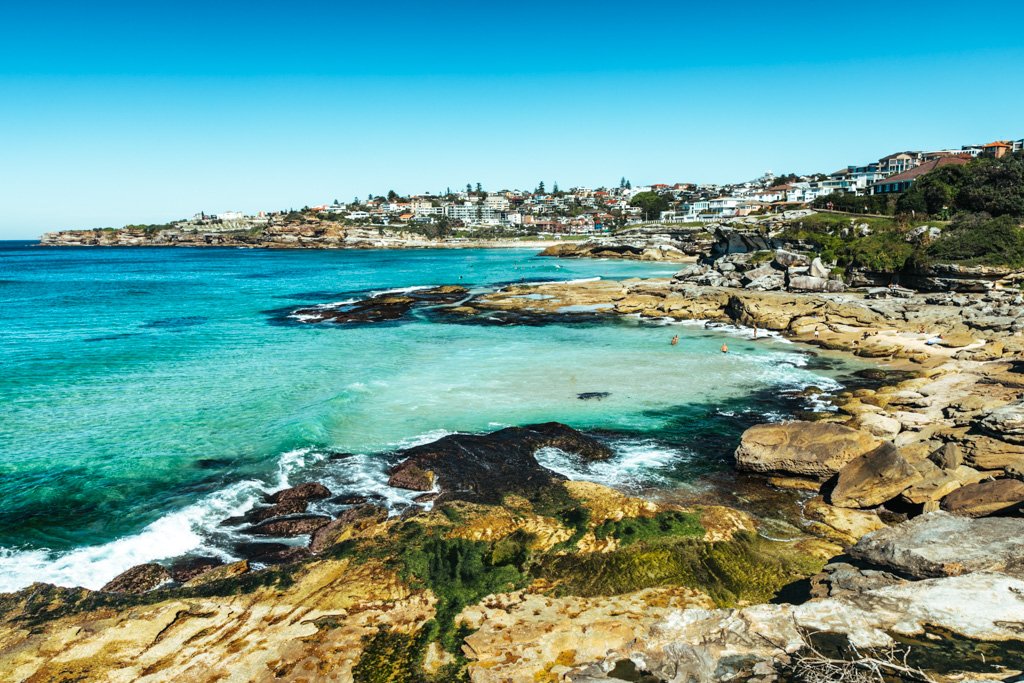
Mackenzies Bay.
How to get there: Bondi and Coogee are both easily accessible by bus from Sydney CBD. Take the 380/333 to Bondi, and the 372/373/374 to Coogee.
Length & Difficulty: 6km / easy
How much time to allow: The full Bondi to Coogee walk takes 1-2 hours if you go nonstop, but you’ll want to allow at least 3 hours and preferably a whole day to stop frequently and enjoy the beaches and views along the way.
You’ll love this Sydney walk if you enjoy: Ocean swimming, beautiful ocean beaches, dramatic coastal views, drinking and dining near the beach
READ MORE IN THIS POST: Bondi to Coogee Walk | Sydney Coastal Walk
Maroubra Beach.
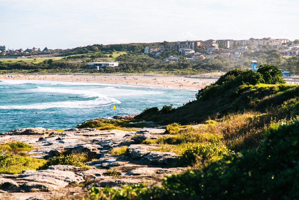
Coogee to Maroubra
If you’re up for a big day, you can tack on the Coogee to Maroubra walk to the Bondi to Coogee walk and do the whole thing in one go.
The Coogee to Maroubra segment is shorter, easier, and much less trodden than Bondi to Coogee. What’s more, there’s plenty to see along the way, including a few ocean baths and an epic rock pool that somehow has not hit Instagram fame yet (shh!). I especially love the cliffs at the very end, just before you reach Maroubra – such cool rock formations here!
Wylies Baths and Coogee Beach.
How to get there: To get to Coogee Beach, take the 313/314/353 bus from Bondi Junction, the 372/373/374 bus from Central Station or the city, the 370 bus from Glebe or Newtown, or the 362 bus from Bondi Beach or Bronte (only runs on weekends from October-April).
Length & Difficulty: 3km / easy
How much time to allow: It takes about an hour to walk from Coogee Beach to Maroubra Beach without stopping. You’ll want to allow at least a half day to fully enjoy the baths and rock pools along the way.
You’ll love this Sydney walk if you enjoy: Getting off the beaten path, ocean pools, rock pools, cliffs, and panoramic coastal views.
READ MORE IN THIS POST: Coogee to Maroubra Walk | Sydney Coastal Walk
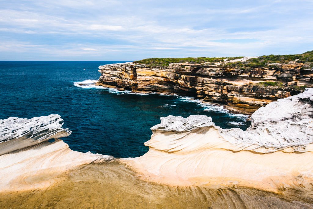
Kurnell to Cronulla
This Sydney hike is perfect for those who want to get off the beaten path don’t mind traveling to the outskirts of Sydney in the name of adventure.
If you’re keen, make your way to the Sutherland Shire to traverse the coastline just south of Botany Bay. The trail for Kurnell to Cronulla has a similar feel to the Royal National Park Coast track just south of Cronulla, but it’s less than half of the length which makes it a much more manageable day trip from Sydney. You’ll see lots of cool rock formations, dramatic cliffs, and possibly whales if you’re hiking during winter months.
The final stretch of the hike has you walking through 5km of sand across Cronulla beach. This part can be a bit exhausting, so I recommend breaking it up with a swim at some point.

How to get there: To get to Cronulla, take the T4 Eastern Suburbs & Illawarra train to the last stop, Cronulla. The ride takes about 50-55 minutes from Sydney’s Central Station.
From Cronulla Station, take the 987 bus up to Kurnell and get off at Kurnell Reserve Captain Cooks Landing at the start of the Monument Track. The ride only takes 15-20 minutes, but the bus does not run frequently so you’ll want to consult Trip Planner or Google Maps to make sure the times line up for the train and bus.
Length & Difficulty: 13km / moderate
How much time to allow: Allow a full day for this Sydney hike. From where the bus drops you off in Kurnell back to Cronulla Station, the Kurnell to Cronulla beach walk should take 4.5 hours nonstop. Do allow extra time to negotiate mud puddles, get a little lost, and slow down and enjoy the views along the way.
You’ll love this Sydney hike if you enjoy: Dramatic coastal views, getting off the beaten path, long walks on the beach, bushwalking (and perhaps puddle jumping).
READ MORE IN THIS POST: Sydney Coastal Walk: Kurnell to Cronulla Beach Walk

Federation Cliff Walk
This 5km clifftop walk runs from Raleigh Reserve in Dover Heights to Gap Park in Watsons Bay. You might want to combine it with the South Head hike mentioned earlier in this post (total distance would be about 10km), which will give you a great taste of both ocean and harbour vistas.
The Federation Cliff Walk runs along the edge of the cliffs of Dover Heights, at times crossing through dog parks and merging with the street. It’s a nice local Sydney hike that you likely won’t see many tourists doing.
My favorite part of the hike is Diamond Bay, which has some precarious stone steps zig zagging down the cliff. They’re mostly just used by fishermen and instagrammers. Parts of the cliff are dangerous though, so if you decide to descend you MUST go slowly and be very careful.
Diamond Bay.
How to get there: Take the 323 or 380 bus to Raleigh Reserve in Dover Heights (the stop is Military Rd at Raleigh St). From Watsons Bay, you can take the ferry or bus 324/325/380 back to the city.
Length & Difficulty: 5km / easy
How much time to allow: 1.5 hours
You’ll love this Sydney walk if you enjoy: Cliffs, parks, lighthouses, street walking
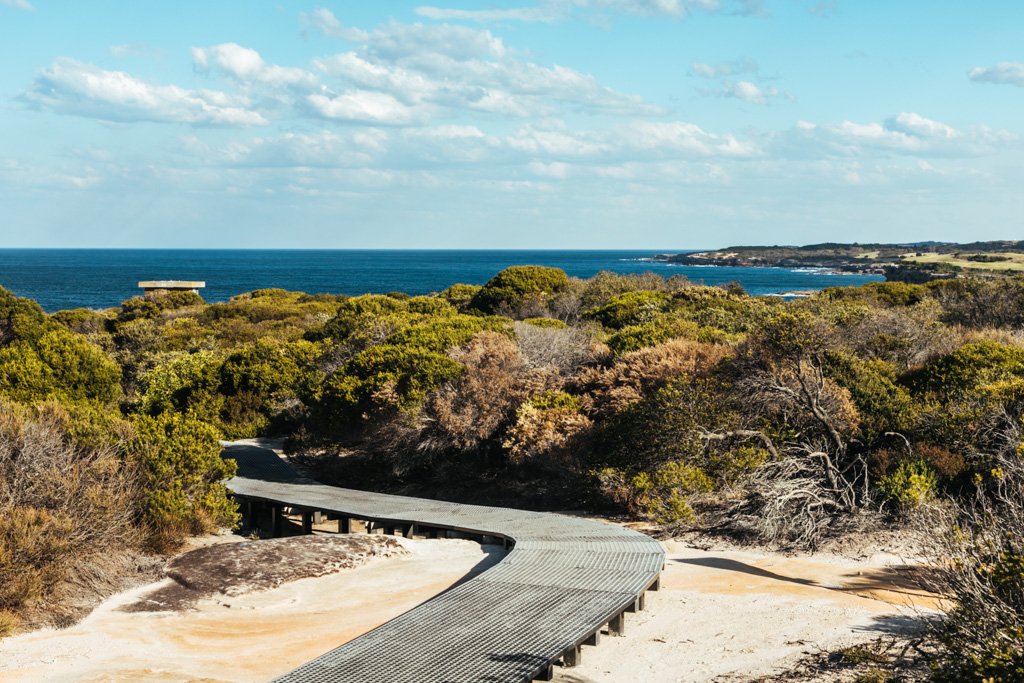
Malabar Headland (Boora Point Walking Track)
Malabar National Park is situated on the headland between Maroubra Beach and Malabar Beach and just a few years ago, the Boora Point walking track opened up to the public there. It’s a nice little track that goes along the sandstone cliffs and inland through bush before emerging at Boora Point, the heart of the headland.
Parts of the track have boardwalk installed, which makes for some fairly comfortable walking. If you’re feeling extra adventurous, you can veer off-track and look for the old batteries, tramline, and underground tunnels – they’re inland from Boora Point. And as with several of the other coastal bush walks in Sydney, there’s a good chance you’ll spot some whales offshore during winter months.
Note that this track is closed on Saturdays as well as the third Sunday of the month, when the rifle range is in use.
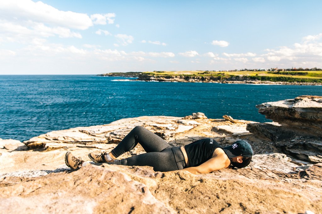
Napping at Boora Point.
How to get there: Take the 353/376/377/395 bus to Maroubra Beach, and the 393/394/399 bus from Malabar Beach.
Length & Difficulty: 5km / easy
How much time to allow: 1.5 hours for the hike + more time for the beaches on either end
You’ll love this Sydney hike if you enjoy: Cliffs, bushwalks, old military remnants, wildflowers, whale watching

La Perouse Walking Tracks
This walk around La Perouse (a suburb very close to Sydney Airport) actually combines two walking tracks: the Henry Head walking track and the Cape Banks walking track. Together, they trace the coastline of Botany Bay from La Perouse.
If you’re short on time/stamina, the Henry Head track goes along the coastline from La Perouse and back, at just 4km return. The Cape Banks track includes the Henry Head track PLUS carries on further down the coast and back, at 7km return.
If you make it to La Perouse, be sure to check out Congwong Beach and Little Congwong Beach, two local favorites (note that Little Congwong is a nude beach). Bare Island is also worth a jaunt – it’s a tiny island connected to the mainland by a footbridge. You’ll glimpse all of these while on this bush walk in Sydney.

Bare Island.
How to get there: Take the 394 bus to/from La Perouse
Length & Difficulty: 7km / easy
How much time to allow: 2 hours
You’ll love this Sydney walk if you enjoy: Coastal walks, rock hopping, military history, bush walks, plane spotting
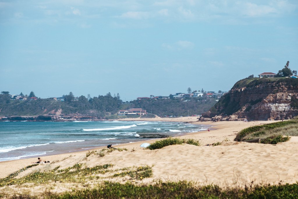
Northern Beaches Coast Walk
The Northern Beaches Coast Walk spans the entire Northern Beaches region of Sydney, with most of the track lining the coast. You’ll be walking on boardwalks, rocks, sand, and road at various points, which keeps things interesting.
The entire 36km walking track from Palm Beach to Manly is slated to be completed by early 2021, but most of it is already done (save for the segment from Newport to Avalon, where you can just walk on the main road in the meantime).
If 36km is too much Sydney hiking for one day, you can just walk a smaller segment of the track. Curl Curl to Freshwater is a good stretch, where you can enjoy rock pools, ocean pools, and sand dunes en route.
Freshwater rock pools.
How to get there: Take the L90 bus to Palm Beach, and the ferry from Manly back to Sydney CBD.
Length & Difficulty: 36km / moderate
How much time to allow: A full day
You’ll love this Sydney hike if you enjoy: BEACHES
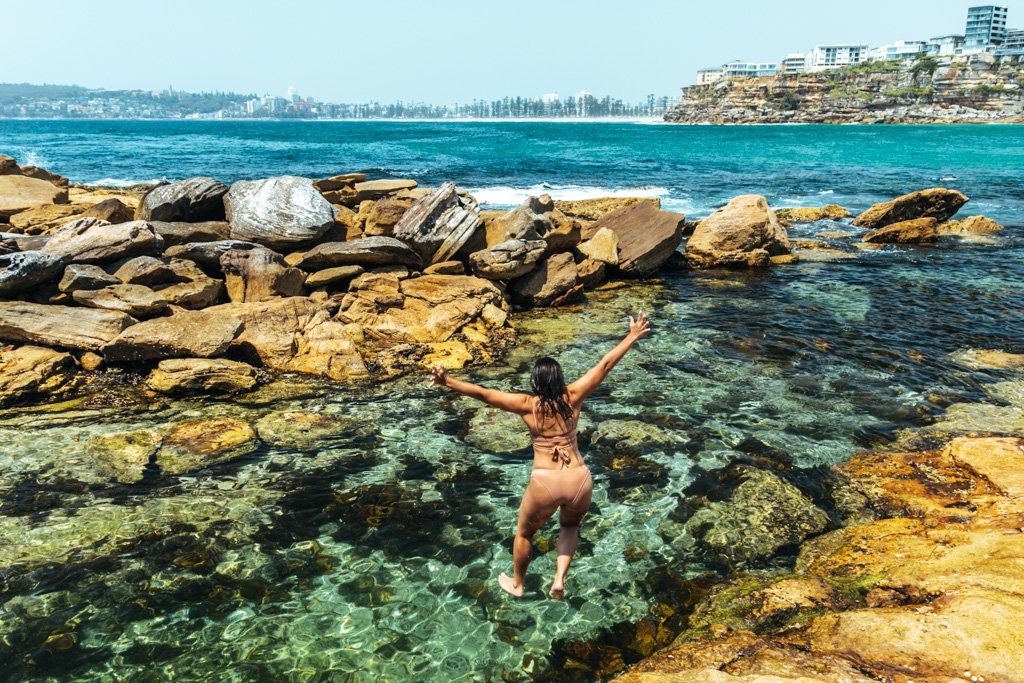
Barrenjoey Lighthouse Walk
This Sydney hiking trail sits at the city’s northernmost point, on the Barrenjoey Headland at Palm Beach. You might have seen photos of it already, but just in case… here’s what’s store for you at the top of the headland if you tackle this Sydney hike:

If you’re like me, this view might distract you from the fact that the trail actually continues with a loop around the headland… but it does, and there’s more hiking goodness and views over Palm Beach, Pittwater, and Ku-ring-gai Chase National Park as you venture on. Plus a heritage-listed lighthouse. Yep, this is definitely one of the more memorable hikes in Sydney.
Palm Beach itself is also well worth a visit after you hike – it’s beloved as the filming location for Home and Away, a popular Aussie soap… but even without that fame, it’s a stunning beach.
How to get there: Take the L90 bus to/from Palm Beach from Sydney CBD
Length & Difficulty: 2.2km loop / moderate
How much time to allow: 1.5 hours
You’ll love this Sydney hike if you enjoy: Epic views from high up, lighthouses, beaches