This post was last updated on 2022 July 3
This is a guest post by Deb of My Debstinations.
—
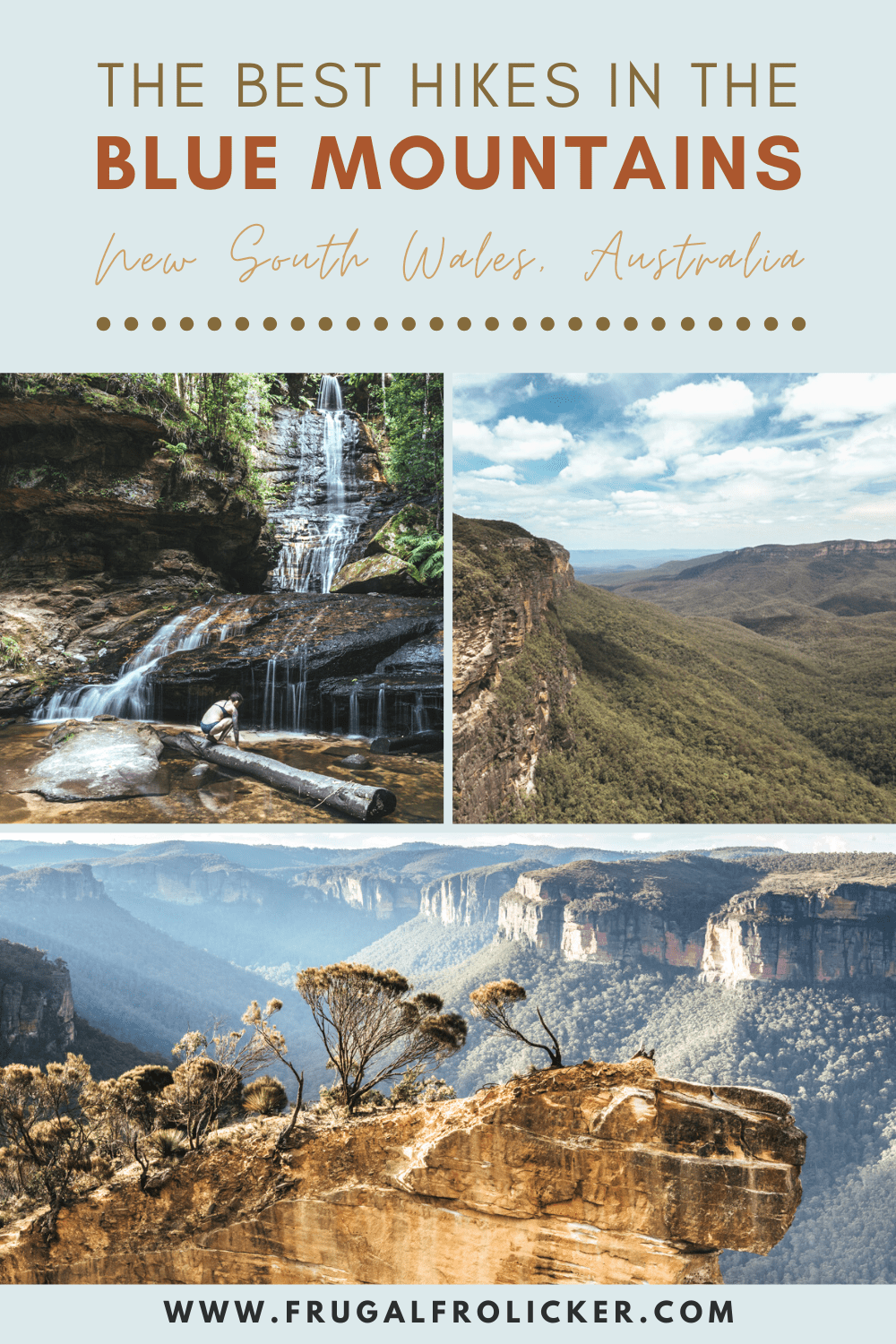
The Blue Mountains are a favorite Sydney weekend getaway and day trip hotspot for locals and tourists alike. Featuring lush eucalyptus forests, waterfalls, and sensational cliffside views, most any Blue Mountains hike is guaranteed to knock your socks off.
We’ve rounded up the best hikes in the Blue Mountains, ranging from easy day hikes to more challenging multi-day hikes, all of which yield stunning views throughout their entirety.
Please note that partial parts of the Blue Mountains bushwalking tracks listed below may be closed for maintenance. We suggest consulting the official NSW National Parks site for the most up-to-date information on track closures throughout the Blue Mountains.
Day Hikes in the Blue Mountains
Grand Canyon Track
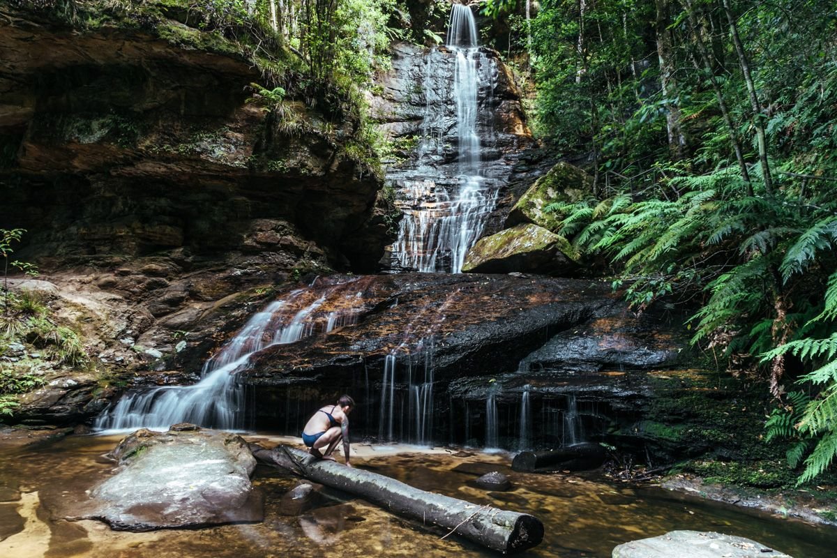
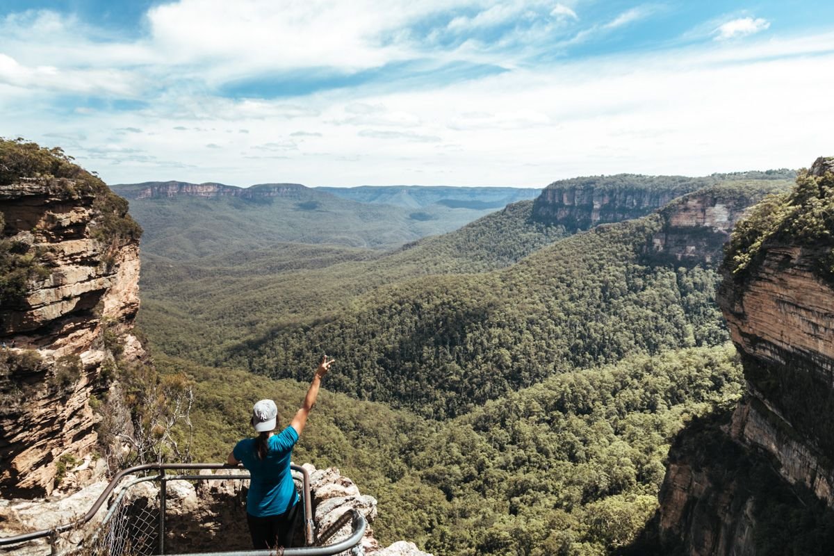
Located in the Blackheath area of the Blue Mountains, this 6.3km loop trail rewards you with a multitude of waterfalls, creeks, and stunning views that will allow you to embrace the beauty of this national park.
As a Grade 3 trail, it’s a bit on the challenging side… but as long as you allow yourself 3-4 hours to complete it, you should be golden.

If you’d like a virtual tour of the track to determine whether it’s a fit for you beforehand, check out Google Street View Trekker’s map here. Also be sure to consult the NSW National Parks and Wildlife Service site for all updated trail information.
How to get there: Starts/ends at Evans Lookout
Length & Difficulty: 6.3km return /Moderate
How much time to allow: 3-4 hours
READ MORE IN THIS POST: Hiking The Grand Canyon in Australia’s Blue Mountains
National Pass (Wentworth Falls Track)
National Pass (which includes the shorter Wentworth Falls track) is most likely to pop up when you’re searching online for Blue Mountains hikes. This is the most popular Blue Mountains hike, and for good reason – it’s a stunner!
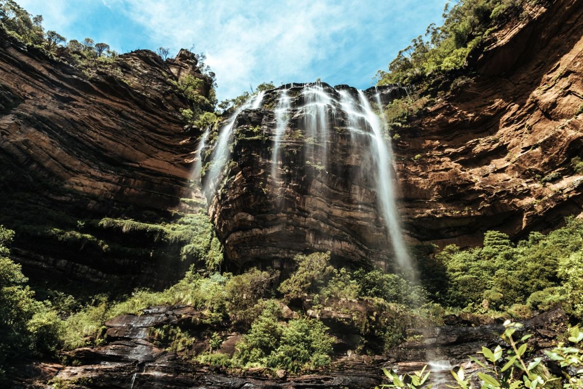
Just a fair note of caution, though – this track isn’t for those who are afraid of heights, since you’ll have a LOT of steep stairs and ladders to climb down in order to reach Wentworth Falls. While it’s definitely one of the most breathtaking hikes ever, ensure that you’ve researched this one properly (and that you’re going with someone or a few others who are established hikers).
The track is a 4.5km loop and is described as a Grade 4, challenging hike. However, if you only want to do the Wentworth Falls Track (where you hike down to the falls and then go back that same way), it’s 1.4km return (45 min – 1 hr). However, I recommend you do the entire National Pass trail, since it’s much easier that way.
When I did this Blue Mountains hike, I had a slight detour due to trail closures (as of August 2020, the Valley of the Waters and Slacks Stairs are closed due to rockfall). So I ended up doing the Wentworth Falls Conservation Hut loop, which started at the Wentworth Falls picnic area and ended at Conservation Hut.
This track took a total of 4 hrs 45 min (including the time it took to walk back to our car at the picnic area, which was only about 15 minutes).
As mentioned above, once you get to Wentworth Falls, I’d highly recommend you continuing on the track, following signs toward Conservation Hut. Otherwise, you’ll go back the way you came, which isn’t glamorous… unless you welcome the challenge of climbing up steep ladders and stairs (and there are a LOT).
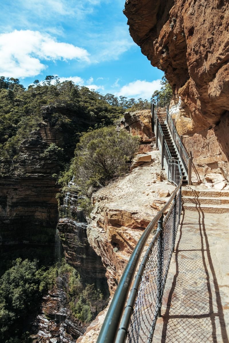
The remainder of the track from the falls toward Conservation Hut is pretty smooth-sailing, and there are small yellow arrows that point the way sporadically if you ever feel like you’re getting off track. The only precarious part of this track are the 7 ladders and 200 stairs.
Get up-to-date info on the track here and here.
How to get there: Starts/ends at the Wentworth Falls picnic area
Length & Difficulty: 4.5 km loop / Moderate to Difficult
How much time to allow: 2.5-3.5 hours
Three Sisters Walk
This track is an easy one, timing in around 25-45 min. for 0.8 km. It’s a family-friendly trail that still yields breathtaking views (especially at the Lady Game lookout).
The trail starts at Echo Point Visitor Centre and takes you to the top of the Giant Stairway, over Honeymoon Bridge, and then to the first “sister.” When trekking back, don’t miss Spooners Lookout (marked with decent signage). You won’t regret stopping to see these gorgeous views at some of the best Blue Mountains lookouts!

If you’re more inclined to carry on with longer walks, never fear! There are other trails nearby, such as the Prince Henry Cliff walk, Dardanelles Pass loop, and the Three Sisters Walk to Scenic World.
Click here for more up-to-date information on this track.
How to get there: Starts/ends at Echo Point
Length & Difficulty: .8 km return / Easy
How much time to allow: 25-45 min
Round Walking Track (Katoomba Falls)
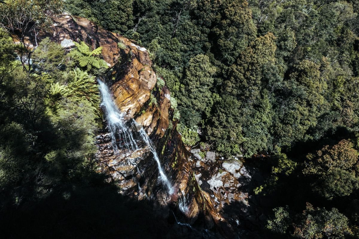
This is one of the easiest Blue Mountains walks, clocking in at 45 min for a 1.2km loop, and you’re rewarded at the end by being up close to one of the most famous waterfalls in the Blue Mountains: Katoomba Falls.
You’ll trek through forest greenery on this track, so it’s slightly cooler, making it an ideal Blue Mountains hike for the summer. Park your car at Scenic World and follow the signs to Prince Henry Cliff Walk. If you get lost, check out Sydney Uncovered for specific guidance.
Along the way, you can stop at several Blue Mountains lookouts (i.e. Reids Plateau, Vanimans Lookout, Juliet’s Balcony), all of which yield jaw-dropping panoramic views of the Three Sisters, Katoomba Falls, and the Witches Leap waterfall.

When you reach your destination (Katoomba Falls), expect to see a crackle of cockatoos (yes, a group of cockatoos is formerly called a “crackle”, who knew?!) waiting for you at the bottom of the falls. It’s the perfect photo op for your future Christmas cards!
Click here for more up-to-date information on this track.
How to get there: Starts/ends at Scenic World
Length & Difficulty: 1.2km loop / Easy
How much time to allow: 45min
Princes Rock
This relatively easy track is another short and sweet Blue Mountains hike (1.8km return, <1 hr). Some of the best Blue Mountains lookouts are on this trail, so you’ll definitely want to add this to your plans if you’re short on time.
Start from the Wentworth Falls picnic area and follow the trail as you get stunning views of Jamison Valley throughout your walk.
Click here for more up-to-date information on the Princes Rock walking track, or take a virtual tour of the track via Google Street View Trekker.
How to get there: Starts/ends at Wentworth Falls picnic area
Length & Difficulty: 1.8km return / Easy
How much time to allow: 30min – 1 hour
Overcliff-Undercliff Track
The Overcliff-Undercliff walk is one of the easier Blue Mountains hikes, which starts from the Wentworth Falls picnic area and continues until you reach the Valley of the Waters.
The majority of this scenic track is through lush rainforest with picturesque photo ops of cliff tops and rocky edges. The Undercliff track joins Overcliff track at Den Fenella track junction, and the signage is frequent enough that you’ll always be able to navigate easily.
Click here for more up-to-date information on this walk.
How to get there: Starts/ends at Wentworth Falls picnic area
Length & Difficulty: 3.5km return / Easy
How much time to allow: 1-2 hours
Lyrebird Dell Round Walk
The Lyrebird Dell Round Walk is near Leura and great for combining with other Blue Mountains walks in the area (such as Princes Rock and Round Walking Track, mentioned above). It only takes about 45 min – 1 hr to finish this relaxing, easy peasy 1.7km loop.
Start this Blue Mountains hike at the Gordon Falls picnic area, wind through a beautiful gorge canyon, and make your way down a steep set of stairs to the Pool of Siloam (marked by signs). If you go in the summer, this pool is quite popular to have a refreshing dip in the water.
As you make your way up to Lyrebird Dell, you’ll come across an Aboriginal cave with a long-standing history.
Click here for more up-to-date information on this walk.
How to get there: Starts/ends at Gordon Falls picnic area
Length & Difficulty: 1.7km return / Easy
How much time to allow: 45min – 1 hour
Ruined Castle
The Ruined Castle walking track is one of the more challenging Blue Mountains hikes (Grade 4; 6.6km return), and you’ll need to allow at least 4-5 hrs to complete it. As with most long hikes, it’s advisable to start as early as possible.
Begin this Blue Mountains hike at the Golden Stairs, and as you make your way down through Jamison Valley, you’ll climb the Ruined Castle, a renowned landmark in the Blue Mountains. The challenge of this trail is worth it, for you’ll be rewarded with stunning views of the valley (you’ll even be able to see Wentworth Falls and Katoomba).
The trail continues into the rainforest and calls for some scrambling over large boulders to reach the Ruined Castle. Once you’ve reached your destination, you’ll enjoy remarkable views of Cedar Creek and Jamison Valleys.
Click here for more up-to-date information on this walk. Note: As of November 2020, this track is closed due to fire damage.
How to get there: Starts/ends at Golden Stairs in Katoomba
Length & Difficulty: 6.6km return / Difficult
How much time to allow: 4-5 hours
Pierces Pass to Blue Gum Forest
If you’re looking for full-day hikes in the Blue Mountains, check out Pierces Pass to Blue Gum Forest in Blackheath. The trail is 16km return (allow 6-8 hrs) and a bit more challenging at Grade 4, but the views are worthwhile.
Start at the Pierces Pass car park and continue through the Fairy Grotto and dense rainforest. Cross the Grose River to get to the Blue Gum Forest, which is home to a wonderland of Eucalyptus deanei trees.

If you want, you can even camp down in the forest and make this a 2-day hike by camping at Acacia Flat campground. Who wouldn’t want to be one with the birds out in this lush rainforest?
Click here for more up-to-date information on this track.
How to get there: Starts/ends at Pierces Pass car park in Blackheath
Length & Difficulty: 16km return / Difficult
How much time to allow: 6-8 hours
Federal Pass
Federal Pass is one of the longest day hikes in the Blue Mountains (12-ish hours, but you can also split this into a 2-day hike) and clocks in as a 13km one-way track. If you’re looking for another hard trail to push the comforts of your fitness levels, try this one.
You can either start this trail from Leura Forest or Katoomba Falls – whichever suits your fancy. The track leads you down to Ruined Castle, alongside forests, waterfalls, and the Three Sisters.
Be warned that you’ll need to be equipped for some challenging climbs up and down the valley if you take on this trail. When I was finishing up my easy walk down to Katoomba Falls, a group of hikers passed by carrying giant packs and rope, with sweat pouring down all of them.
This is definitely one of the more challenging Blue Mountains hikes, but the scenic views are well worth it!
Click here for more up-to-date information on the Federal Pass track.
How to get there: Starts from Leura Forest or Katoomba Falls
Length & Difficulty: 26km return (13km one way) / Difficult
How much time to allow: 12+ hours
Victoria Falls
One of the shorter Blue Mountains bushwalks is the hike to Victoria Falls. All you need is about 2-2.5 hrs to spare, but keep in mind that it’s a medium-level hike due to its steep grade on the trek back.
You’ll start from the Victoria Falls car park, where you’ll almost immediately be rewarded by the Victoria Falls lookout. Continue following the track to the left of the lookout, and trek carefully down the steep zig-zagged path down the cliff.
You’ll pass Victoria Creek Cascades as well as the top of Victoria Falls, and if you continue on, you’ll hit the bottom of the 20m-high waterfall.
Click here for more up-to-date information on the Victoria Falls track.
How to get there: Starts/ends at Victoria Falls car park
Length & Difficulty: 4km return / Moderate
How much time to allow: 2-2.5 hours
Burramoko Ridge (Hanging Rock) Trail
For a picturesque medium-level Blue Mountains hike in the Grose Wilderness, try this 10km walk (more famously known as the Hanging Rock trail). Note that this trail also serves as a mountain bike route, so be extra cautious of your surroundings!
You’ll begin this trail in Blackheath (along Ridgewell Rd) and walk through lush forest until you reach the Baltzer lookout (aka Hanging Rock). It will be very obvious how the Hanging Rock trail got its name once you reach this epic Blue Mountains lookout.

If you want to actually step foot onto Hanging Rock for that classic Instagram shot, do so with extreme caution, as you’ll need to jump across an 80cm-wide gap. PLEASE only proceed if you’re absolutely sure you’re physically capable of landing the jump!
Click here for more up-to-date information on this track.
How to get there: Starts/ends in Blackheath
Length & Difficulty: 10km return / Moderate
How much time to allow: 2 hours
Overnight Hikes in the Blue Mountains
Six Foot Track
For the truly ambitious outdoorsy folk, the Six Foot Track is a challenging 3-day Blue Mountains hike from Katoomba to Jenolan Caves.
With a length of 46km, make sure you’re well-equipped for this type of hike and that you’re going with someone who is familiar with the track (or, if trekking it solo, rent a personal locator beacon).
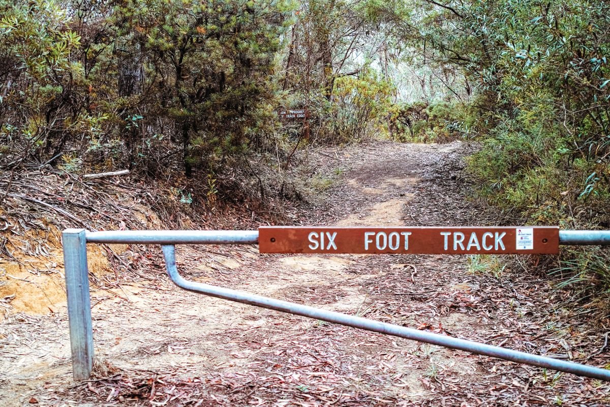
The track starts at Explorers Tree near Katoomba and winds past cascading waterfalls, rivers, and across a swing bridge, until you finally arrive at Jenolan Caves.
Click here for more up-to-date information on this track, and check out a full website dedicated specifically to the Six Foot Track here.
How to get there: Starts at Explorers Tree near Katoomba and ends at Jenolan Caves
Length & Difficulty: 46km one-way / Difficult
How much time to allow: 3 days
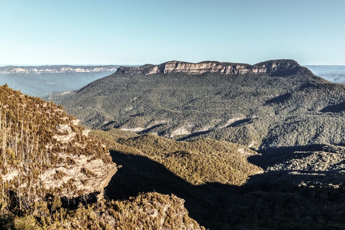
Mount Solitary
Mount Solitary is a challenging 3-day hike. As a 34km loop marked as Grade 5, this track tops our list for the most difficult in terms of climbing and grade, so be sure you’re in physically fit condition before committing to this or any of the other multi-day Blue Mountains hikes.
You can either camp on the mountain or in a cave along this trail (and channel your inner Hobbit while doing so!).
The track starts at Katoomba Falls Kiosk and weaves you through rainforest, Eucalyptus trees, and vast lands as you descend down to Federal Pass.
According to the official NSW NPS site, day 1 covers 7km, day 2 covers 9km of more difficult terrain, and day 3 involves 14km of walking. Be sure to plan out your route beforehand so you’re not huffing and puffing to your destination by the third day!
This Blue Mountains hike also passes through the Ruined Castle, along Kedumba River, and finally through Leura forest and gully (Fern Bower). You can even choose to take the Prince Henry Cliff walk toward the end (mentioned in #4 above), so you can ideally combine a few of the shorter Blue Mountains walks throughout this behemoth trail, if you’re so inclined.
Click here for more up-to-date information on this track.
How to get there: Starts/ends at Katoomba Falls Kiosk
Length & Difficulty: 34km loop / Difficult
How much time to allow: 3 days